
Dosiye:EU-Poland.svg

Size of this PNG preview of this SVG file: pixels 713 × 600. Ubundi bwaguke: pixels 285 × 240 | pixels 571 × 480 | pixels 913 × 768 | pixels 1.218 × 1.024 | pixels 2.435 × 2.048 | pixels 2.045 × 1.720.
Dosiye nkomoko (SVG file, nominally 2.045 × 1.720 pixels, file size: 7,33 MB)
польша
Incamake
Polski:
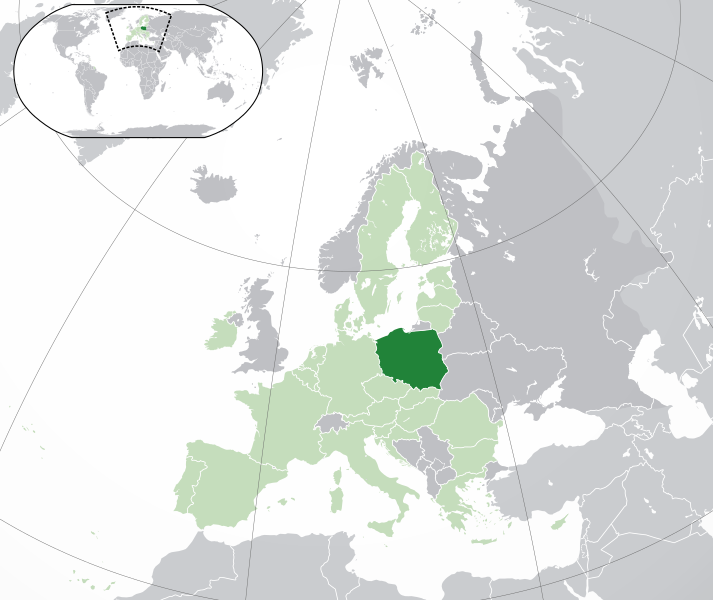
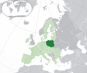
(Green) Polska.
(Light-green) Unia Europejska (UE).
(Gray) Europa.
(Light-gray) Inne terytoria.
| Umwidondoro |
English: (Dark-Green) Poland. (Light-Green) The rest of the European Union (EU). (Dark-gray) The rest of Europe. (Light-gray) The surrounding region.
See also: |
| SVG genesis | |
| Igenekerezo | |
| Inkomoko | Own work based on: Location European nation states.svg |
| Umwanditsi | NuclearVacuum |
| Other versions |
|
| SVG genesis |


Uburenganzira
I, the copyright holder of this work, hereby publish it under the following licenses:
Iyi dosiye yemewe kuri Creative Commons Attribution-Share Alike 3.0 Unported license.
- Uridegemvya:
- gusangiza – mukwimura, kwiragiza wongere utange igikorwa
- guhinyanyura – kujanisha igikorwa
- Ku mategeko akurikira:
- umurimo – Utegerezwa gutanga inkuru injanye, tanga umurongo ku ruhushya, kandi erekana ko habaye impinduka. Urashobora kubikora muburyo ubwo aribwo bwose busiguritse, ariko atari mu buryo ubwo aribwo bwose bwerekana ko uwatanze uburenganzira agushigikiye canke ashigikiye ibikoresho vyawe.
- Imigabane ingana – Mugihe uhinyanyuye, uhinduye, canke wisunze iki gikorwa, utegerezwa gutanga intererano zawe kuri same or compatible license kumwe n'igikorwa c'inkomoko.

|
Hatanzwe uruhusha rwo kwimura, gukwiragiza canke guhinyanyura ibi vyandiko hakoreshejwe uruhusha rwa GNU Free Documentation License, Umuce wa 1.2 canke umuce uwariwo wose washizeho inyuma ya Free Software Foundation; ata gice ntahinduka, ata majambo y'urupapuro rw'intango canke rw'iherezo. Kwimuru uruhusha biri mu muce witwa GNU Free Documentation License. |
Ushobora gucagura uruhusha ushaka.
Amateka ya dosiye
Fyonda kw'igenekerezo/isaha kugirango urabe dosiye nkuko yagaragaye uwo mwanya.
| Igenekerezo/Isaha | Iparati | Uburinganire | Uwukoresha | Insiguro | |
|---|---|---|---|---|---|
| muri iki gihe | 05:19, 1 Ruhuhuma 2020 | | 2.045 × 1.720 (7,33 MB) | Rob984 | UK and Gibraltar have left the EU. New base which includes all of Portugal's islands within frame, as well as Arctic Russian islands part of Europe. Also fixed Flevoland in the Netherlands. |
| 20:34, 25 Gitugutu 2016 |  | 2.045 × 1.720 (7,32 MB) | Giorgi Balakhadze | fix | |
| 09:25, 24 Kigarama 2015 |  | 2.045 × 1.720 (7,33 MB) | Nordwestern | Per original framework and Commons' rules. Agree with A2D2. | |
| 15:58, 18 Ntwarante 2015 |  | 2.045 × 1.720 (7,38 MB) | Mapclean | Reverted to Leftcry's version, please go to your talk page | |
| 14:10, 21 Ruhuhuma 2015 |  | 2.045 × 1.720 (2,61 MB) | VS6507 | Spain. Greece. Slovakia. Cyprus. Romania VETO | |
| 19:34, 16 Munyonyo 2014 |  | 2.045 × 1.720 (7,38 MB) | Leftcry | Reverted to version as of 15:48, 6 August 2014 Please go to your talk page | |
| 16:36, 16 Munyonyo 2014 |  | 2.045 × 1.720 (2,61 MB) | A2D2 | The map must show the original de-jure status with no breakaway regions, as it was originally created. An alternative map showing the de-facto status with breakaway regions needs to be created instead. | |
| 15:48, 6 Myandagaro 2014 |  | 2.045 × 1.720 (7,38 MB) | Rob984 | Improved version: More accurate coastline, borders, etc. Added Gradient and Longitude and latitude lines. Sudan border. | |
| 09:31, 1 Mukakaro 2013 |  | 2.045 × 1.720 (2,61 MB) | U5K0 | croatia | |
| 14:41, 23 Gitugutu 2009 |  | 2.045 × 1.720 (2,59 MB) | NuclearVacuum | consensus version |
Ikoreshwa rya dosiye
Ntampapuro zikoresha ino dosiye
Ikoreshwa rya dosiye muri rusangi
Izindi wiki zikurikira zikoresha iyi dosiye:
- Ikoreshwa kuri ace.wikipedia.org
- Ikoreshwa kuri ady.wikipedia.org
- Ikoreshwa kuri af.wikipedia.org
- Ikoreshwa kuri ami.wikipedia.org
- Ikoreshwa kuri ar.wikipedia.org
- العلاقات البولندية السعودية
- مستخدم:ElWaliElAlaoui/ملعب 8
- معاملة المثليين في بولندا
- مستخدم:جار الله/قائمة صور مقالات العلاقات الثنائية
- العلاقات الأمريكية البولندية
- العلاقات الأنغولية البولندية
- العلاقات البولندية الكورية الجنوبية
- العلاقات الإريترية البولندية
- العلاقات البولندية السويسرية
- العلاقات البولندية الليختنشتانية
- العلاقات البولندية البوليفية
- العلاقات البولندية الموزمبيقية
- العلاقات الألبانية البولندية
- العلاقات البلجيكية البولندية
- العلاقات الإثيوبية البولندية
- العلاقات البولندية البيلاروسية
- العلاقات البولندية الطاجيكستانية
- العلاقات البولندية الروسية
- العلاقات الأرجنتينية البولندية
- العلاقات البولندية الغامبية
- العلاقات البولندية القبرصية
- العلاقات البولندية السيراليونية
- العلاقات البولندية النيبالية
- العلاقات البولندية الليبيرية
- العلاقات التشيكية البولندية
- العلاقات البولندية الميانمارية
- العلاقات البولندية الكندية
- العلاقات البولندية الزيمبابوية
- العلاقات الإسرائيلية البولندية
- العلاقات البالاوية البولندية
- العلاقات البولندية المالية
- العلاقات البولندية النيجيرية
- العلاقات اليمنية البولندية
- العلاقات البولندية الفانواتية
- العلاقات الغابونية البولندية
- العلاقات البنمية البولندية
- العلاقات البولندية الكوبية
- العلاقات البولندية الجورجية
- العلاقات البولندية التونسية
- العلاقات البولندية الكورية الشمالية
- العلاقات الهندية البولندية
- العلاقات اليابانية البولندية
- العلاقات الإيطالية البولندية
- العلاقات البولندية الناوروية
- العلاقات الأسترالية البولندية
- العلاقات البولندية الزامبية
Raba ikoresha muri rusangi ry'ino dosiye.